Land Surveyor in Raleigh, NC
Raleigh, NC land surveyor providing boundary and property line surveys, ALTA/NSPS land title surveys, topographic mapping, construction staking/layout, subdivision plats, as-built surveys, and FEMA elevation certificates for projects across Raleigh and Wake County.
Our Services
Professional Land Surveying & 3D Laser Scanning Services in Raleigh, NC

Land Surveying Raleigh, NC
Need Land Surveying in Raleigh, NC to close on property, design an addition, or resolve a boundary line? Crews verify deeds with Wake County GIS and Register of Deeds records, flag encroachments in Five Points and Oakwood, map topography for North Hills infill, and deliver ALTA/NSPS, boundary, and construction staking. We locate utilities, greenway and NCDOT rights‑of‑way, and City of Raleigh stormwater and Neuse buffer limits so your site plan passes permitting. Elevation certificates address FEMA and Crabtree Creek floodplain risks. Choose a team that understands clay soils, impervious caps, and subdivision plat requirements: Land Surveying in Raleigh, NC.

Residential Land Surveying Raleigh, NC
Need Residential Land Surveying in Raleigh, NC? We map property lines, easements, and elevations so you can close on schedule, pull permits, or resolve fence and driveway encroachments. Plats meet Wake County Register of Deeds requirements and City of Raleigh Permit and Development Portal submittals, including site plans for additions, decks, and ADUs. We identify Neuse River buffers, greenway and utility easements, FEMA flood zones near Crabtree Creek, and tree conservation areas that change setbacks. Order boundary, topographic, or lot recombination surveys. Receive clear CAD and signed PDFs lenders accept. Learn more: Residential Land Surveying in Raleigh, NC today.

Commercial Land Surveying Raleigh, NC
You need clear boundaries and fast approvals. Commercial Land Surveying in Raleigh, NC verifies parcels against Wake County GIS, Raleigh UDO, and Neuse buffer rules, preventing setback, stormwater, and floodplain surprises. We deliver ALTA/NSPS surveys, mapping, zoning summaries, and Phase I ESA coordination that lenders, attorneys, and title companies accept. Resolve encroachments, right‑of‑way and utility easements near NCDOT corridors like Capital Blvd and New Bern Ave BRT, and map access and parking to meet site plan review. Choose Commercial Land Surveying in Raleigh, NC to accelerate closings, protect investments, and navigate infill constraints across Midtown, Brier Creek, and Downtown.

Construction Surveying Raleigh, NC
Choose Construction Surveying in Raleigh, NC to keep foundations, utilities, and paving laid out correctly on tight infill lots from Five Points to South Park. We stake building corners, grade, curb, and stormwater features to City of Raleigh tolerances using robotic total stations, GNSS, and control tied to NC grid. We verify setbacks, NCDOT rights‑of‑way, and Duke Energy easements before you dig. Receive machine control files, progress shots, and as‑builts that satisfy Raleigh as‑built submittals and Neuse River buffer rules. We flag clay, drainage conflicts, and elevation mismatches early. Request Construction Surveying in Raleigh, NC and keep inspections moving.

Land Development Services Raleigh, NC
Choose Land Development Services in Raleigh, NC that solve issues: interpreting the City of Raleigh UDO, mapping floodplains along Crabtree Creek, and meeting Neuse River buffers. We deliver boundary and topographic surveys; subdivision and recombination plats; and site grading data tailored to Wake County stormwater and NCDOT driveway permits. Avoid redesigns by catching utility conflicts with SUE coordination and precise as-builts. We help you navigate tree conservation, erosion control, and riparian setbacks in North Hills, Brier Creek, and Falls Lake. Land Development Services in Raleigh, NC. Contact us for Land Development Services in Raleigh, NC that move projects forward.

Home Builder & Construction Survey Services Raleigh, NC
Choose Home Builder & Construction Survey Services in Raleigh, NC to stake lots, lay out foundations, and verify grading on infill sites inside the Beltline. We flag setbacks, Neuse River buffers, tree save areas, and impervious limits so plans satisfy City of Raleigh reviews and Wake County stormwater rules. We mark utilities, protect easements, and deliver as-builts that pass inspections and keep framers ready. Our crews handle clay soils and narrow rights-of-way common in Midtown and Five Points. Order Home Builder & Construction Survey Services in Raleigh, NC to prevent encroachments, avoid rework, secure permits faster, and hold schedules.

Real Estate Closing & Home Owner Services Raleigh, NC
Need precise Real Estate Closing & Home Owner Services in Raleigh, NC? We verify boundaries for Inside-the-Beltline lots, provide mortgage location surveys, plot plans, and staking for fences, sheds, and additions. Our crews flag setbacks per City of Raleigh code, check floodplain near Crabtree and Neuse corridors, and identify Duke Energy and sewer easements that derail permits. We coordinate with Wake County Register of Deeds for closing exhibits and eRecording. Choose Real Estate Closing & Home Owner Services in Raleigh, NC to avoid encroachments, deed-call mismatches, and ROW surprises. Local insight speeds HOA approvals and resolves property line disputes.

Laser Scanning Raleigh, NC
Choose Laser Scanning in Raleigh, NC to capture dense point clouds of downtown warehouses, Village District retail spaces, and North Hills towers without shutting down operations. You get millimeter-level existing conditions, Scan to BIM for Revit and AutoCAD, and reliable as-built 2D plans pulled straight from verified data. We document tight crawlspaces, sloped lots in Five Points, and code-sensitive historic homes in Oakwood, reducing rework and unexpected change orders. Measure remotely, coordinate trades, and plan renovations around utilities before you open a wall. For turnarounds and site access, use Laser Scanning in Raleigh, NC—precise, Laser Scanning in Raleigh, NC.
Services Areas
Serving North Carolina, NC Wake County & the Greater Triangle
Raleigh Metro
- Angier
- Apex
- Carrboro
- Cary
- Chapel Hill
- Clayton
- Durham
- Fuquay-Varina
- Garner
- Hillsborough
- Holly Springs
- Knightdale
- Morrisville
- Pittsboro
- Raleigh
- Rolesville
- Wake Forest
- Wendell
- Zebulon
Charlotte Metro
- Belmont
- Charlotte
- Concord
- Cornelius
- Davidson
- Gastonia
- Harrisburg
- Huntersville
- Indian Trail
- Kannapolis
- Matthews
- Mint Hill
- Monroe
- Mount Holly
- Pineville
- Wesley Chapel
Can't find your area?
Give us a call at (919) 402-6742. We regularly take on projects throughout the Piedmont and Coastal regions of North Carolina for commercial clients with specific needs.

Reviews
Trusted by Homeowners, Contractors & Developers Across Wake County
About Our Land Surveying Services in Raleigh, NC
Meta Geomatics PLLC in Raleigh, NC provides boundary surveys, ALTA/NSPS land title surveys, topographic mapping, construction staking, subdivision plats, and easement/right‑of‑way surveys. Services include flood elevation certificates, as-built surveys, property line staking, and GIS mapping support. Our team prepares plats for recording in Wake County and coordinates with engineers, architects, and title companies. We use GPS/RTK and robotic total stations for accurate measurements, deliver CAD and PDF files, and handle residential lots, commercial sites, roadway corridors, and utility projects across the Raleigh area.
About Raleigh, NC
Raleigh blends planned design with oak-lined streets and research-driven growth rooted in its role as North Carolina’s capital. Residents and businesses value reliable infrastructure, universities, and a diverse workforce. Landmarks include the North Carolina State Capitol, Pullen Park, Dorothea Dix Park, Raleigh Union Station, and UNC REX Hospital, anchoring government, recreation, transit, and healthcare. From lot staking near North Hills to boundary retracement around historic Oakwood, crews use NC-record research, localized control networks, and RTK/PPK GPS to handle Raleigh’s terrain and tree cover. Precise ALTA/NSPS, topographic, and construction layout surveys support projects by NC State, Dorothea Dix Park, and downtown infill, with plats and digital deliverables formatted for Wake County submittals.
Raleigh's population is 469,124. City center coordinates: 35.7796, -78.6382. Humid subtropical conditions bring hot, storm-prone summers, clay-rich soils, and occasional winter freezes. Meta Geomatics PLLC accounts for expansive clays, drainage, and vegetation growth in boundary, topographic, and construction staking surveys, using stable control, seasonal-adjusted elevations, and erosion-aware mapping while meeting North Carolina Board of Examiners for Engineers and Surveyors standards and 21 NCAC requirements. - Five Points: boundary and topographic surveys for infill lots and additions. Our team uses recycled materials and sustainable methods, minimizing waste on every project. We also support Raleigh’s community through local collaborations and education. Choose a partner committed to Raleigh, NC. For reliable Land Surveyor services in Raleigh, contact Meta Geomatics PLLC today.

Overcast Clouds
Temperature
Wind Speed
Humidity
Neighborhoods We Serve
Things to Do
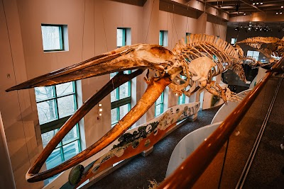
North Carolina Museum of Natural Sciences

Pullen Park
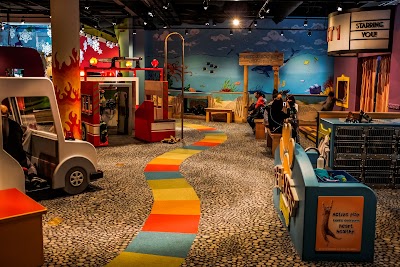
Marbles Kids Museum

Mordecai Historic Park

North Carolina State Capitol

North Carolina Museum of Art
JC Raulston Arboretum

Frankie's of Raleigh
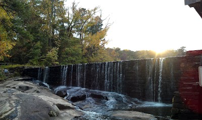
Historic Yates Mill County Park

Pope House Museum

CAM Raleigh

William B. Umstead State Park

WRAL Azalea Garden

Joel Lane Museum House

Boylan Bridge

City of Raleigh Museum

Dorothea Dix Park

Lake Johnson Park

Nash Square

Ann and Jim Goodnight Museum Park
Transportation
Moore Square
Greyhound: Bus Station
Blount St at GoRaleigh Station
North Carolina MBDA Bus Center
Lenoir St at Haywood St
Raleigh Union Station
N Wilmington St at North St (R8)
Wilmington St at Hargett St (GoRaleigh Station)
E Morgan St at S Person St
West St at Hargett St (R13)
GoRaleigh Station (city and regional transit bus)
E Lane St at N East St
Poplar St at N Blount St
Hillsborough St at Brooks Ave(NCSU)
Cameron St at Daniels St (WB)
McDowell St at Martin St
Holmes St at E Bragg St
Morgan St at Boylan Ave
New Bern Ave at Carver St
Salisbury St at W Davie St
Driving Directions
Driving Directions from Newcomb Land Surveyors, PLLC to Meta Geomatics PLLC
Driving Directions from Scalice Land Surveying, P.C. to Meta Geomatics PLLC
Driving Directions from Residential Land Services to Meta Geomatics PLLC
Driving Directions from Angle Right Land Surveying to Meta Geomatics PLLC
Driving Directions from GSC Surveying Inc to Meta Geomatics PLLC
Driving Directions from Krause Surveying Associates to Meta Geomatics PLLC
Driving Directions from Boundary Zone Inc. to Meta Geomatics PLLC
Driving Directions from Robinson & Plante Land Surveying to Meta Geomatics PLLC
Driving Directions from MSS Land Consultants to Meta Geomatics PLLC
Driving Directions from Turning Point Surveying PLLC to Meta Geomatics PLLC
Driving Directions from Stokes Surveying & Mapping, PLLC to Meta Geomatics PLLC
Driving Directions from SAM to Meta Geomatics PLLC
Driving Directions from Sullivan Surveying to Meta Geomatics PLLC
Driving Directions from C H Engineering to Meta Geomatics PLLC
Driving Directions from Cawthorne Moss & Panciera Professional Land Surveyors to Meta Geomatics PLLC
Driving Directions from Freehold Land Surveys Inc to Meta Geomatics PLLC
Driving Directions from Stewart Proctor PLLC to Meta Geomatics PLLC
Driving Directions from Murphy Geomatics to Meta Geomatics PLLC
Driving Directions from Surveywerks to Meta Geomatics PLLC
Ready to Get Started?
Contact us today for a free, no-obligation quote:
Phone
Office Hours
Monday – Friday, 8:00 AM – 5:00 PM
Most quotes provided within 24 hours. Emergency and expedited services available.