Land Surveyor in Huntersville, NC
Land surveyor in Huntersville, NC for boundary and property line surveys, ALTA/NSPS land title surveys, topographic surveys and mapping, construction staking/layout, subdivision and recombination plats, as-built surveys, elevation certificates and FEMA LOMA/LOMR, and site/GIS mapping for residential, commercial, and municipal projects in Huntersville, Lake Norman, and Mecklenburg County.
Our Services
Professional Land Surveying & 3D Laser Scanning Services in Huntersville, NC

Land Surveying Huntersville, NC
Need a boundary, topo, or ALTA survey before a Lake Norman teardown, pool, or addition? Land Surveying in Huntersville, NC clarifies property lines in Birkdale, Northstone, and Vermillion, prevents setback violations, and documents easements for Mecklenburg County permitting. We locate encroachments along fences, map steep lots near Torrence Creek floodplains, stake new builds, and deliver CAD and GIS files your designer can use. Local crews understand Duke Energy utility corridors, town right-of-way standards, and NCDOT driveway tie-ins. Get plats for closings, elevation certificates for flood insurance, and construction staking that keeps schedules on track: Land Surveying in Huntersville, NC.

Residential Land Surveying Huntersville, NC
Residential Land Surveying in Huntersville, NC helps you close on a home, design an addition, or resolve a fence dispute with boundary, topo, and site plans tailored to Mecklenburg County requirements. We map encroachments near McDowell and Torrence Creek floodplains, check Duke Energy and drainage easements, and prepare permit-ready plans for Town of Huntersville formal review. Get lender surveys, HOA submittals, and shed layouts that avoid setbacks along Lake Norman and NCDOT rights-of-way on Sam Furr. Choose Residential Land Surveying in Huntersville, NC to prevent costly rework. For subdivision or recombination, request Residential Land Surveying in Huntersville, NC today.

Commercial Land Surveying Huntersville, NC
Need Commercial Land Surveying in Huntersville, NC for a purchase, refinance, or redevelopment near I‑77 exits 23–25, Birkdale Village, or along NC‑73? We perform ALTA/NSPS Land Title Surveys, boundary and topographic mapping, construction staking, and as‑builts that satisfy title companies, lenders, and attorneys. We verify right‑of‑way with NCDOT, map Duke Energy and Charlotte Water easements, flag Lake Norman watershed buffers, and identify encroachments that derail closings. Receive clear plats, zoning summaries per the Huntersville Zoning Ordinance, and coordinated Phase I ESA support. Meet tight deadlines with sealed documentation. Choose Commercial Land Surveying in Huntersville, NC to reduce risk locally.

Construction Surveying Huntersville, NC
Construction Surveying in Huntersville, NC keeps your build accurate from clearing to closeout. We stake building corners, utilities, curb and gutter, and retaining walls to prevent encroachments common on tight lakefront lots near Lake Norman. We produce as-builts for Mecklenburg LUESA and Charlotte Water approvals, and verify grades to meet SWIM buffer and erosion control requirements. Our crews use robotic total stations and GNSS to deliver sub-centimeter layout, even along I‑77 frontage and sloped sites. Track progress with cut/fill reports and checkpoints. Choose Construction Surveying in Huntersville, NC for coordination. Search Construction Surveying in Huntersville, NC to start.

Land Development Services Huntersville, NC
Land Development Services in Huntersville, NC guide you from feasibility to permitting with site-specific data for Lake Norman and I‑77 corridor projects. Get boundary and topographic surveys, subdivision plats, and grading stakeout that align with Town of Huntersville zoning, tree save rules, and SWIM buffers. We coordinate with Mecklenburg County LUESA, NCDOT driveway permits, and Charlotte Water for sewer and water taps. Solve red clay erosion control, floodplain constraints, and Duke Energy easement conflicts before submittal to cut re-reviews. Use traffic and utility mapping to place access and BMPs correctly. Start here: Land Development Services in Huntersville, NC today.

Home Builder & Construction Survey Services Huntersville, NC
Choose Home Builder & Construction Survey Services in Huntersville, NC to stake lot corners, set foundation offsets, verify grading, and deliver as-builts matching Mecklenburg County plans. We navigate Huntersville setbacks, tree‑save rules, and McDowell Creek watershed buffers, so your footing elevations and driveway tie‑ins pass LUESA inspections. We mark easements and Duke Energy limits to prevent conflicts before concrete. Builders in Birkdale, Northstone, Vermillion, and lakefront parcels get fast site readiness, fewer change orders, and accurate walls, porches, and curb lines. Get Home Builder & Construction Survey Services in Huntersville, NC that avoid rework and keep schedules on track.

Real Estate Closing & Home Owner Services Huntersville, NC
Searching for Real Estate Closing & Home Owner Services in Huntersville, NC? We deliver boundary and mortgage surveys that satisfy Mecklenburg County and lender requirements, coordinate with closing attorneys, and flag encroachments common around Birkdale, Northstone, and Lake Norman shorelines. Our staked lines and plot plans support Town of Huntersville permits for fences, pools, additions, and sheds, including HOA submittals. We verify setbacks and floodplain near McDowell Creek, helping you avoid violations and rework. For waterfront parcels, we map docks and riparian areas for Duke Energy reviews. Explore Real Estate Closing & Home Owner Services in Huntersville, NC for details.

Laser Scanning Huntersville, NC
Laser Scanning in Huntersville, NC captures millimeter-accurate existing conditions for lakefront remodels near Lake Norman, tenant upfits in Birkdale Village, and industrial spaces along Statesville Road. Avoid change orders by obtaining high‑density point clouds, Scan to BIM for Revit/AutoCAD, and 2D as‑builts pulled directly from scans. Verify slab flatness, wall plumb, roof lines, and pier alignments; measure remotely when permits, HOA reviews, or contractor bids require defendable data. Map tight property lines, stormwater features, and utility conflicts around I‑77 interchanges. Choose crews who understand Mecklenburg County submittals. Start here: Laser Scanning in Huntersville, NC—precise, Laser Scanning in Huntersville, NC.
Services Areas
Serving North Carolina, NC Wake County & the Greater Triangle
Raleigh Metro
- Angier
- Apex
- Carrboro
- Cary
- Chapel Hill
- Clayton
- Durham
- Fuquay-Varina
- Garner
- Hillsborough
- Holly Springs
- Knightdale
- Morrisville
- Pittsboro
- Raleigh
- Rolesville
- Wake Forest
- Wendell
- Zebulon
Charlotte Metro
- Belmont
- Charlotte
- Concord
- Cornelius
- Davidson
- Gastonia
- Harrisburg
- Huntersville
- Indian Trail
- Kannapolis
- Matthews
- Mint Hill
- Monroe
- Mount Holly
- Pineville
- Wesley Chapel
Can't find your area?
Give us a call at (919) 402-6742. We regularly take on projects throughout the Piedmont and Coastal regions of North Carolina for commercial clients with specific needs.

Reviews
Trusted by Homeowners, Contractors & Developers Across Wake County
Trusted Land Surveyors Serving Huntersville, NC
Meta Geomatics PLLC provides land surveying services in Huntersville, NC, including boundary and property line surveys, ALTA/NSPS surveys, topographic surveys for design, construction staking and layout, subdivision plats, elevation certificates, FEMA floodplain determinations, and as-built/record surveys. Our team prepares plats for permitting and recording in Mecklenburg County, resolves deed and boundary discrepancies through record research, and delivers CAD and GIS files for engineers and architects. Services support residential lots, commercial sites, roadway improvements, utilities, and site development across Huntersville and nearby Lake Norman communities.
About Huntersville, NC
Huntersville, NC blends lake-country landscapes with a past rooted in agriculture and rail expansion. Residents and businesses value quick access to greenways, modern retail, and corporate parks. Notable landmarks include Town Hall, Discovery Place Kids–Huntersville, Huntersville Athletic Park, Novant Health Huntersville Medical Center, and the historic Latta Nature Preserve, offering education, recreation, and community events. Their crews handle boundary, topo, and ALTA/NSPS surveys with site-specific control for Lake Norman shoreline parcels, Birkdale Village infill, and industrial tracts near I‑77. They coordinate utility locates along Gilead and Sam Furr roads, resolve right‑of‑way questions around historic Rural Hill, and deliver plats, CAD files, and digital deliverables that align with Mecklenburg County and Huntersville permitting requirements.
Huntersville's population is 61,376. City center coordinates: 35.4107, -80.8428. The area has humid subtropical conditions with hot summers, mild winters, and frequent summer thunderstorms. Meta Geomatics PLLC tailors boundary, topographic, and construction staking surveys to manage clay-heavy soils, drainage, and rapid development near Lake Norman, using GNSS/RTK and resilient control. All work complies with NC Board of Engineers and Surveyors standards and NCGS §47-30. In Birkdale, we provide boundary and ALTA/NSPS surveys for homeowners and retail parcels. In Vermillion, we handle platting and construction staking. Near Rosedale, we perform topographic surveys. In Northstone, we deliver lot line adjustments and elevation certificates. We prioritize eco-friendly practices, using recycled materials where possible and sustainable methods on every project, while actively supporting Huntersville’s community initiatives and local development efforts. For reliable Land Surveyor services in Huntersville, contact Meta Geomatics PLLC today.

Broken Clouds
Temperature
Wind Speed
Humidity
Neighborhoods We Serve
Things to Do

Historic Latta Plantation

Historic Rural Hill

Carolina Raptor Center

Latta Nature Preserve

Discovery Place Kids-Huntersville

Cowans Ford Wildlife Refuge

Frankie's of Charlotte

R.C. Bradford Park

SEA LIFE Charlotte-Concord

Rosedale Nature Park

Veterans Park

U.S. National Whitewater Center

Holbrook Park

Spare Time Huntersville
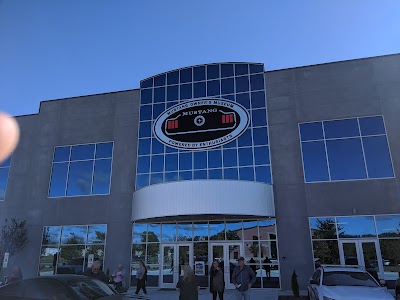
Mustang Owner's Museum

Jetton Park

Carowinds

Robbins Park

UNC Charlotte Botanical Gardens

iFLY Indoor Skydiving - Charlotte
Transportation
Northcross Park & Ride
Old Statesville Rd @ Huntersville Municipal Bldg
Reese Blvd. & Kincey Ave
Statesville Rd & Northcross Center Ct
Old Statesville Rd & Mt Holly Huntersville Rd
Statesville Rd & Huntersville Commons Dr
Huntersville Gateway Park & Ride
Old Statesville Rd @ Huntersville Municipal Bldg
Gilead Rd & Reese Blvd
Sam Furr Rd & Sedgebrook Ln
Old Statesville Rd & Mt Holly Huntersville Rd
Sam Furr Rd & Birkdale Commons Pkwy
Bryton Town Center Dr @ Walmart (Southbound)
Northlake Mall (1st stop)
Olympic Transportation
Sam Furr Rd & Northcross Dr
Gilead & Old Statesville
Gilead Rd @ Huntersville Presbyterian Hospital
Statesville Rd & Metroment Pkwy
Old Statesville Rd & Hambright Rd
Driving Directions
Driving Directions from Joseph C Roberts Land Surveying, PLLC to Meta Geomatics PLLC
Driving Directions from Pyramid Land Surveying PA to Meta Geomatics PLLC
Driving Directions from D.A.S Don Allen & Associates, PA Land Surveying to Meta Geomatics PLLC
Driving Directions from NC Precision Surveys to Meta Geomatics PLLC
Driving Directions from Legacy Surveying PLLC to Meta Geomatics PLLC
Driving Directions from Bateman Civil Survey Company to Meta Geomatics PLLC
Driving Directions from Dunbar Geomatics Group PLLC to Meta Geomatics PLLC
Driving Directions from ESP Associates, Inc. to Meta Geomatics PLLC
Ready to Get Started?
Contact us today for a free, no-obligation quote:
Phone
Office Hours
Monday – Friday, 8:00 AM – 5:00 PM
Most quotes provided within 24 hours. Emergency and expedited services available.