Land Surveyor in Concord, NC
Land surveyor in Concord, NC providing boundary and property line surveys, ALTA/NSPS land title surveys, topographic surveys, construction staking, subdivision plats, as-built surveys, FEMA elevation certificates, and floodplain mapping for residential and commercial sites.
Our Services
Professional Land Surveying & 3D Laser Scanning Services in Concord, NC

Land Surveying Concord, NC
Need clear boundaries, permits, or construction staking? Land Surveying in Concord, NC verifies property lines in neighborhoods like Moss Creek and Christenbury, resolves fence and driveway encroachments, and prepares plats for the Cabarrus County Register of Deeds. We provide ALTA/NSPS surveys near Concord Mills, elevation certificates along Irish Buffalo Creek and Rocky River, and septic and setback surveys meeting review. Navigate NCDOT right‑of‑way on Poplar Tent and George Liles Parkway, confirm utility easements, and map topography for additions. Choose expertise that speaks the City of Concord checklist. Start here: Land Surveying in Concord, NC supporting lenders, builders, homeowners today.

Residential Land Surveying Concord, NC
Choose Residential Land Surveying in Concord, NC to resolve fence and driveway encroachments, confirm setbacks for City of Concord permits, and map floodplain limits along Cold Water Creek. We produce surveys for closings, lender ALTA/NSPS when required, site plans for additions, deck or pool permits, and recombination or subdivision plats. Identify utility easements for Duke Energy, Piedmont Natural Gas, and City of Concord water/sewer before you dig. We verify HOA boundary monuments in Afton Village and Moss Creek. Request Residential Land Surveying in Concord, NC and get maps, coordination with planners. Residential Land Surveying in Concord, NC protects investment.

Commercial Land Surveying Concord, NC
Need data that closes deals in Concord? Commercial Land Surveying in Concord, NC verifies boundaries and easements for acquisitions along I‑85, Concord Mills, and the Charlotte Motor Speedway corridor. Receive ALTA/NSPS Land Title Surveys, utility locates, topographic mapping, and staking that match lender, attorney, and title checklists. We document zoning compliance under the Concord Development Ordinance, confirm setbacks, parking ratios, access on NC 73 and US 29/49, and flag NCDOT right‑of‑way or Duke Energy encroachments. Diligence packages include Phase I ESA coordination and floodplain/stormwater reviews via Cabarrus County GIS. Choose Commercial Land Surveying in Concord, NC to meet timelines.

Construction Surveying Concord, NC
Get precise layouts for footings, utilities, curb, and paving with Construction Surveying in Concord, NC. We translate plans into staked points, control lines, and digital models that match City of Concord standards, Cabarrus County permits, and NCDOT details along I‑85 and Concord Mills Boulevard. Verify slab elevations, ADA ramps, pipe inverts, and as‑builts to pass inspections first time. Track progress, cut/fill, and grade to prevent rework on Piedmont clays and lots near Rocky River and Irish Buffalo Creek. Coordinate with Duke Energy and Water Resources easements. Choose Construction Surveying in Concord, NC to keep schedules tight and budgets predictable.

Land Development Services Concord, NC
Tap Land Development Services in Concord, NC to turn raw parcels into buildable lots that meet the City of Concord UDO. We deliver boundary surveys, topographic mapping, subdivision plats, and grading data that speed approvals with Planning & Zoning, Stormwater, and NCDOT driveway permits near I‑85 and NC‑73. Resolve encroachments, wetlands, and Rocky River floodplain issues early, avoid redesigns, and coordinate utilities with Water Resources and Duke Energy. File plats at the Cabarrus County Register of Deeds without surprises. Choose Land Development Services in Concord, NC to move from concept to construction. Land Development Services in Concord, NC now.

Home Builder & Construction Survey Services Concord, NC
Need precise staking in Moss Creek, Afton Village, or Christenbury? Our Home Builder & Construction Survey Services in Concord, NC mark lot corners, lay out foundations, verify grading, and produce as-builts that pass City of Concord inspections. We flag Duke Energy and utility easements, confirm NCDOT driveway locations, and check setbacks required by Cabarrus County. Crews align accurately. We solve sloped lots and red clay with accurate cuts/fills, and map stormwater tie-ins near Rocky River buffers. Home Builder & Construction Survey Services in Concord, NC. Hire local Home Builder & Construction Survey Services in Concord, NC; reduce change orders.

Real Estate Closing & Home Owner Services Concord, NC
Searching for Real Estate Closing & Home Owner Services in Concord, NC? Get boundary and mortgage surveys that satisfy Cabarrus County and City of Concord permit reviewers, HOA boards in Moss Creek and Afton Village, and lender underwriting. We locate property corners, map easements along Duke Energy and City utility corridors, confirm setbacks on mill-village lots near Historic Downtown, and stake fences so you avoid encroachments. Rely on turnarounds coordinated with closing attorney and the Cabarrus County Register of Deeds. Start here: Real Estate Closing & Home Owner Services in Concord, NC for clear plats and fewer surprises locally.

Laser Scanning Concord, NC
Need precise as-builts for a Concord renovation? Laser Scanning in Concord, NC captures dense point clouds of mills, speedway facilities, and retail spaces at Concord Mills. You get Revit/AutoCAD-ready Scan to BIM models, ceilings and MEP clashes documented before demo, and 2D plans extracted for permit sets with Cabarrus County. Verify slab flatness, structural deflection, and façade plumb on mill homes and upfits. Reduce site visits with a digital record and remote measurements. Laser Scanning in Concord, NC helps contractors, architects, and owners coordinate. Local crews know downtown access and campus schedules. Laser Scanning in Concord, NC solves guesswork.
Services Areas
Serving North Carolina, NC Wake County & the Greater Triangle
Raleigh Metro
- Angier
- Apex
- Carrboro
- Cary
- Chapel Hill
- Clayton
- Durham
- Fuquay-Varina
- Garner
- Hillsborough
- Holly Springs
- Knightdale
- Morrisville
- Pittsboro
- Raleigh
- Rolesville
- Wake Forest
- Wendell
- Zebulon
Charlotte Metro
- Belmont
- Charlotte
- Concord
- Cornelius
- Davidson
- Gastonia
- Harrisburg
- Huntersville
- Indian Trail
- Kannapolis
- Matthews
- Mint Hill
- Monroe
- Mount Holly
- Pineville
- Wesley Chapel
Can't find your area?
Give us a call at (919) 402-6742. We regularly take on projects throughout the Piedmont and Coastal regions of North Carolina for commercial clients with specific needs.

Reviews
Trusted by Homeowners, Contractors & Developers Across Wake County
Experienced Land Surveyors Serving Concord, NC
Meta Geomatics PLLC provides land surveying services in Concord, NC, including boundary surveys for residential and commercial parcels, ALTA/NSPS land title surveys, topographic surveys for design, construction staking for site work and utilities, subdivision and recombination plats, as-built surveys, FEMA elevation certificates, and GIS mapping support. Our firm also performs easement and right-of-way plats, lot line adjustments, and floodplain determinations. Surveys are prepared to North Carolina standards, with clear deliverables such as CAD files, signed plats, and digital reports suited for permitting and development.
About Concord, NC
Concord, NC blends mill village roots and racing heritage with a growing commercial core. Residents value walkable downtown streets, craft eateries, and strong public services. Businesses benefit from access to regional highways and a skilled workforce. Notable landmarks include Cabarrus County Courthouse, Atrium Health Cabarrus, Concord Mills, Frank Liske Park, and Dorton Park, anchoring civic life and recreation. From downtown parcels near Union Street to properties bordering the Rocky River, crews use site-specific control, deed research, and utility coordination to resolve boundary, topo, and ALTA needs without disrupting traffic or neighbors. We adapt workflows for Concord’s mixed zoning, historic districts, and active construction corridors, delivering clear plats, CAD files, and rapid stakeholder communication to keep projects moving.
Concord's population is 111,820. City center coordinates: 35.4088, -80.5795. The area has hot, humid summers, mild winters, and frequent summer thunderstorms that can affect ground moisture and GPS reception. Meta Geomatics PLLC schedules fieldwork around precipitation, uses multi-constellation GNSS with RTK, and applies robust control networks. All plats, boundary surveys, and ALTA/NSPS surveys comply with North Carolina G.S. §47‑30 and NC Board of Examiners standards. In Cabarrus Country Club, we handle boundary surveys for lot line adjustments; in Christenbury, construction staking for new builds; in Moss Creek, elevation certificates for floodplain compliance; in Laurel Park, ALTA/NSPS surveys; and in Zemosa Acres, topographic mapping. We use recycled materials and sustainable methods where possible and actively support Concord’s community through local partnerships and projects across Cabarrus County. For reliable Land Surveyor services in Concord, contact Meta Geomatics PLLC today.

Clear Sky
Temperature
Wind Speed
Humidity
Neighborhoods We Serve
Things to Do

SEA LIFE Charlotte-Concord
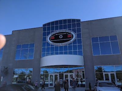
Mustang Owner's Museum

MagiQuest

Dorton Park

Bost Grist Mill

Xtreme Play

iFLY Indoor Skydiving - Charlotte

Frank Liske Park

Memorial Garden

The Speedpark at Concord Mills

Cabo Winery

Great Wolf Lodge Water Park | Concord

Vietnam Veterans Park

NASCAR Racing Experience

North Carolina Music Hall Of Fame

Les Myers Park

Reed Gold Mine

Carowinds

Carolina Raptor Center

Charlotte Motor Speedway
Transportation
Orange Line Bus Stop
Orange Line Bus Stop
Orange Line Bus Stop
Orange Line Bus Stop
Orange Line Bus Stop
Orange Line Bus Stop
Orange Line Bus Stop
Orange Line Bus Stop
Orange Line Bus Stop
Orange Line Bus Stop
Orange Line Bus Stop
Green Line Bus Stop
Orange Line Bus Stop
Orange Line Bus Stop
Orange Line Bus Stop
Orange Line Bus Stop
Orange Line Bus Stop
Orange Line Bus Stop
Green Line Bus Stop
Green Line Bus Stop
Driving Directions
Driving Directions from NorStar Land Surveying, Inc. to Meta Geomatics PLLC
Driving Directions from CESI Civil-Geotechnical-Surveying to Meta Geomatics PLLC
Driving Directions from Whitehall Land Survey to Meta Geomatics PLLC
Driving Directions from DDE Land Surveying & Consulting, P.A. to Meta Geomatics PLLC
Driving Directions from HARRISBURG SURVEYING to Meta Geomatics PLLC
Driving Directions from Coore Land Surveying to Meta Geomatics PLLC
Driving Directions from Pyramid Land Surveying PA to Meta Geomatics PLLC
Driving Directions from Joseph C Roberts Land Surveying, PLLC to Meta Geomatics PLLC
Driving Directions from Suther Engineering, PLLC to Meta Geomatics PLLC
Driving Directions from Phoenix Land Surveying, Inc. to Meta Geomatics PLLC
Driving Directions from Jackie G. Duncan, PLS, CFS to Meta Geomatics PLLC
Driving Directions from Legacy Surveying PLLC to Meta Geomatics PLLC
Driving Directions from Jenkins & Lowery, PLS P.A. to Meta Geomatics PLLC
Driving Directions from Gobble Land Surveying to Meta Geomatics PLLC
Driving Directions from ESP Associates, Inc. to Meta Geomatics PLLC
Driving Directions from Rhyne Land Surveying to Meta Geomatics PLLC
Driving Directions from The Campbell Group Land Surveying pllc to Meta Geomatics PLLC
Driving Directions from Ronnie Dedmon Surveyors PA to Meta Geomatics PLLC
Ready to Get Started?
Contact us today for a free, no-obligation quote:
Phone
Office Hours
Monday – Friday, 8:00 AM – 5:00 PM
Most quotes provided within 24 hours. Emergency and expedited services available.