Land Surveyor in Holly Springs, NC
Land surveyor in Holly Springs, NC offering boundary and property line surveys, ALTA/NSPS land title surveys, topographic mapping, construction staking/layout, subdivision plats, as-built surveys, FEMA flood elevation certificates and LOMAs, and site plans for residential and commercial projects.
Our Services
Professional Land Surveying & 3D Laser Scanning Services in Holly Springs, NC

Land Surveying Holly Springs, NC
Boundary, topo, or construction stakeout? Land Surveying in Holly Springs, NC pinpoints property lines for additions, fences, and pool permits, avoiding setbacks and HOA violations. We map grades, utilities, and stormwater buffers along Utley Creek, Bass Lake, and Sunset Lake to support drainage plans and Wake County permits. Commercial clients get ALTA/NSPS plats, curb-and-sidewalk staking on NC‑55 and Avent Ferry Road, and easement retracement before closings. Homebuyers secure closing surveys and elevation certificates for flood insurance. Expect CAD files, marked corners, e‑recordable plats for Wake County Register of Deeds. Choose Land Surveying in Holly Springs, NC for precise results.

Residential Land Surveying Holly Springs, NC
Residential Land Surveying in Holly Springs, NC helps you verify boundaries, setbacks, and easements before you buy, build, or add a pool. We map encroachments in 12 Oaks and Sunset Ridge, confirm Duke Energy utility easements, and flag floodplain areas near Bass Lake. Get site plans accepted by the Town of Holly Springs and Wake County lenders, plus boundary, topo, and recombination plats recorded with the Register of Deeds. We stake additions near NC 55 Bypass right‑of‑way, support septic evaluations, and streamline HOA approvals. Start here: Residential Land Surveying in Holly Springs, NC—Residential Land Surveying in Holly Springs, NC.

Commercial Land Surveying Holly Springs, NC
Navigate acquisitions, approvals, and lender requirements with Commercial Land Surveying in Holly Springs, NC. We deliver ALTA/NSPS Land Title Surveys, boundary and topographic mapping, easement plats, construction staking, and Phase I ESA coordination. Get professionally sealed documents title companies, lenders, and attorneys accept. We verify setbacks, buffers, grading, stormwater, signage, and access along NC 55 and Avent Ferry Road, locate utilities tied to Town of Holly Springs records, and flag FEMA floodplains and stream crossings. Reduce delays by resolving encroachments and NCDOT driveway permits early. Choose Commercial Land Surveying in Holly Springs, NC to meet UDO standards and deadlines.

Construction Surveying Holly Springs, NC
Construction Surveying in Holly Springs, NC turns plans into precise layout that passes Wake County inspections. We stake buildings, curb and gutter, utilities, and retaining walls for tight infill lots near downtown and larger pads in 12 Oaks and Honeycutt Farm. Crews use robotic total stations, GPS, and machine control files to hold sub-centimeter tolerances, preventing encroachments into Neuse buffers, Bass Lake wetlands, and NCDOT rights-of-way along NC-55 and Avent Ferry Road. You receive as-builts, cut/fill reports, and elevation checks that resolve grading disputes, verify stormwater structures, and speed CO approvals. Request Construction Surveying in Holly Springs, NC now.

Land Development Services Holly Springs, NC
Choose Land Development Services in Holly Springs, NC that map boundaries, grades, utilities, and buffers so you submit plans the Town approves faster. We survey lots near NC 55, Avent Ferry, and Sunset Lake, flag floodplain along Utley Creek, and verify tree save and Jordan Lake watershed limits. Get boundary, topo, subdivision plats, construction staking, and stormwater as-builts aligned to the Town UDO and Wake County erosion-control rules. We coordinate NCDOT driveway permits, locate undergrounds, and prevent costly redesigns. Land Development Services in Holly Springs, NC help you avoid clay-soil settlement issues, plan pads correctly, and keep builders moving.

Home Builder & Construction Survey Services Holly Springs, NC
Need precise layout for your new build? Our Home Builder & Construction Survey Services in Holly Springs, NC stake house corners, batter boards, and utilities, verify grading on Piedmont clay, and document as-builts for Town of Holly Springs closeouts. We align foundations to tight setbacks in 12 Oaks and Honeycutt Farm, check step-downs on sloped lots near Bass Lake, and confirm drainage to storm inlets. We flag conflicts with easements, right-of-way, and UDO buffers before concrete. Expect clear reports for Wake County permits and scheduling to keep trades moving. Home Builder & Construction Survey Services in Holly Springs, NC.

Real Estate Closing & Home Owner Services Holly Springs, NC
Real Estate Closing & Home Owner Services in Holly Springs, NC help you close on time and build without setbacks. We perform boundary and mortgage surveys, plot plans, and staking that satisfy Town permits, HOA approvals in 12 Oaks and Sunset Ridge, and lender requirements. Our crews flag encroachments, utility and stormwater easements near Middle Creek, and mismapped lots in newer subdivisions. We coordinate with Wake County Register of Deeds and attorneys to reduce rejections. View Real Estate Closing & Home Owner Services in Holly Springs, NC and choose mapping that fits UDO setbacks and pool or fence plans.

Laser Scanning Holly Springs, NC
Laser Scanning in Holly Springs, NC captures point clouds so you can verify existing conditions for homes near Main Street, builds off NC‑55, and tenant improvements in Holly Springs. Measure walls, slabs, roofs, and MEP routes with millimeter accuracy, then export Scan to BIM models for Revit or AutoCAD. Speed permits with clear as-builts for Wake County submittals and NCDOT driveway tie-ins. Avoid site visits; pull remote dimensions anytime. Resolve clashes before you demo or pour. Use Laser Scanning in Holly Springs, NC to document renovations, additions, and fit-outs. Choose Laser Scanning in Holly Springs, NC to reduce rework.
Services Areas
Serving North Carolina, NC Wake County & the Greater Triangle
Raleigh Metro
- Angier
- Apex
- Carrboro
- Cary
- Chapel Hill
- Clayton
- Durham
- Fuquay-Varina
- Garner
- Hillsborough
- Holly Springs
- Knightdale
- Morrisville
- Pittsboro
- Raleigh
- Rolesville
- Wake Forest
- Wendell
- Zebulon
Charlotte Metro
- Belmont
- Charlotte
- Concord
- Cornelius
- Davidson
- Gastonia
- Harrisburg
- Huntersville
- Indian Trail
- Kannapolis
- Matthews
- Mint Hill
- Monroe
- Mount Holly
- Pineville
- Wesley Chapel
Can't find your area?
Give us a call at (919) 402-6742. We regularly take on projects throughout the Piedmont and Coastal regions of North Carolina for commercial clients with specific needs.

Reviews
Trusted by Homeowners, Contractors & Developers Across Wake County
Holly Springs NC Land Surveyors for Precise Mapping
Meta Geomatics PLLC provides land surveying services in Holly Springs, NC, including boundary surveys, ALTA/NSPS land title surveys, topographic mapping, and construction staking for residential and commercial projects. Our firm prepares subdivision plats, easement and right‑of‑way plats, and performs flood elevation certificates and FEMA LOMA/LOMR assistance. Services also include utility as‑builts, site grading and earthwork quantity surveys, and GIS mapping support. Deliverables are provided in CAD and PDF, coordinated with local planners, engineers, and title companies to meet Wake County and Town of Holly Springs requirements.
About Holly Springs, NC
Holly Springs, NC grew from a crossroads around freshwater springs into a fast-growing Wake County town with a planned downtown and modern amenities. Residents and businesses value its safe neighborhoods, tech-ready infrastructure, and local events. Notable landmarks include Holly Springs Town Hall, Ting Park, W.E. Hunt Recreation Center, UNC Health Rex Holly Springs Hospital, and Bass Lake Park. From downtown redevelopment near the Holly Springs Cultural Center to boundary checks around Bass Lake Park, crews adapt methods to each site’s terrain and permitting needs. They coordinate with Wake County records, deliver ALTA/NSPS, boundary, and topo surveys with clear plats, and schedule fieldwork to minimize disruption near schools, neighborhoods, and the NC 55 corridor.
Holly Springs's population is 41,239. City center coordinates: 35.6510, -78.8336. The town has a humid subtropical climate with hot, storm-prone summers and mild, wetter winters. Meta Geomatics PLLC schedules fieldwork to avoid afternoon thunderstorms, uses RTK GPS with canopy-friendly workflows in pine stands, and designs drainage-aware plats, while adhering to North Carolina Board of Examiners for Engineers and Surveyors standards and 21 NCAC requirements. In Twelve Oaks, we provide boundary and topographic surveys for new builds. In Sunset Ridge, we handle lot line adjustments and fence placement mapping. In Braxton Village, we deliver elevation certificates. In Autumn Park, we perform construction staking and site plans. We prioritize eco-friendly practices by using recycled materials where possible and sustainable field methods, while supporting Holly Springs’s community through local partnerships and projects across Wake County. For reliable Land Surveyor services in Holly Springs, contact Meta Geomatics PLLC today.

Overcast Clouds
Temperature
Wind Speed
Humidity
Neighborhoods We Serve
Things to Do

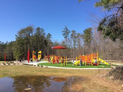
Bass Lake Park

Sugg Farm at Bass Lake Park

Holly Springs Cultural Center
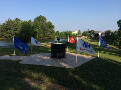
Veterans Park

Parrish Womble Park

Womble Park Athletic Fields

Pullen Park
Jones Park

Hemlock Bluffs Nature Preserve
JC Raulston Arboretum
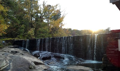
Historic Yates Mill County Park

Whole Brain Escape

Ting Park

North Carolina Museum of Natural Sciences

Marbles Kids Museum
Lake Johnson Park

Changing Tomorrow Farm

Dorothea Dix Park

North Carolina Botanical Garden

North Carolina State Capitol
Transportation
Main St at Center St (SB)
Sportsmanship Way at Ting Park Park-and-Ride
Bus Stop
Apex Peakway at Hughes St (Walmart)
Fuquay-Varina South Park-and-Ride
Mason St at Apex Town Hall (SB)
Hughes St at Williams St (Compare Foods Park-&-Ride (PM))
Star Bus
W Williams St at Apex Peakway (NB)
Laura Duncan Rd at Apex Peakway (SB)
N Salem St at Hunter Street OB
Laura Duncan Rd at Apex Peakway (NB)
Apex Peakway at Hughes St (Cambridge Village)
Crescent Commons Dr at Kildaire Farm Rd
Chatham St at Hughes St
Mason St at Old Mill Village Dr (Apex Town Hall (NB))
Hughes St at Chatham St
Southern Express Inc
Hughes St at James St (SB)
Hughes St at James St (NB)
Driving Directions
Driving Directions from Benton W Dewar & Associates to Meta Geomatics PLLC
Ready to Get Started?
Contact us today for a free, no-obligation quote:
Phone
Office Hours
Monday – Friday, 8:00 AM – 5:00 PM
Most quotes provided within 24 hours. Emergency and expedited services available.