Land Surveyor in Cary, NC
Land surveyor in Cary, NC offering boundary and property line surveys, ALTA/NSPS land title surveys, topographic mapping, construction staking, subdivision plats, as-built surveys, FEMA elevation certificates/LOMAs, and GIS mapping for residential and commercial sites in Cary and surrounding Wake County communities.
Our Services
Professional Land Surveying & 3D Laser Scanning Services in Cary, NC

Land Surveying Cary, NC
Choose Land Surveying in Cary, NC to map boundaries accurately, locate easements, and prevent setback issues before you file permits. We deliver boundary, topo, ALTA/NSPS, and construction staking tailored to Cary’s Land Development Ordinance, Jordan Lake riparian buffers, and HOA requirements. Resolve fence and driveway encroachments, site pools or additions correctly, and speed planning reviews with plats ready for Wake County recording. We verify flood elevations near Swift Creek, mark NCDOT rights-of-way along NC-55 and US-1, and flag utility conflicts. Work with a crew that knows your neighborhood’s plats and corner monuments. Start now: Land Surveying in Cary, NC.

Residential Land Surveying Cary, NC
Need answers before closing, building, or fencing? Residential Land Surveying in Cary, NC verifies boundaries, flags encroachments, and maps topography for permits. We prepare plot plans that meet Town of Cary UDO standards, account for impervious limits under Jordan Lake rules, and note easements near White Oak Creek and Black Creek. Get lender-accepted mortgage surveys, lot recombination plats, and construction staking for additions, pools, and decks. Resolve HOA setback questions and stream buffers in the Neuse River Basin. Choose Residential Land Surveying in Cary, NC for precise maps and permits. Local expertise streamlines Residential Land Surveying in Cary, NC.

Commercial Land Surveying Cary, NC
Commercial Land Surveying in Cary, NC helps you close confidently by exposing boundary gaps, encroachments, and access issues before you commit. We deliver ALTA/NSPS surveys, zoning summaries keyed to the Cary Land Development Ordinance, and due diligence mapping for lenders and attorneys. Verify impervious limits in the Jordan Lake and Neuse basins, riparian buffers along Swift and Crabtree creeks, and greenway or utility easements affecting site layout. We stake pads, curb, and utilities, then produce as-builts for CO. Record-ready, sealed plats meet Wake County standards. Confirm NCDOT driveway access permits. Start here: Commercial Land Surveying in Cary, NC.

Construction Surveying Cary, NC
Choose Construction Surveying in Cary, NC to keep foundations, utilities aligned with Town of Cary approvals. We stake building corners, offsets, and grades so your crew pours once on Piedmont clay and sloped infill near Downtown and Cary Parkway. We verify ADA slopes, curb and gutter elevations, and stormwater features meeting Jordan Lake rules. Our robotic total stations and GNSS set control, monitor, and produce as-builts that pass Wake County and NCDOT reviews. Avoid right-of-way conflicts, HOA setbacks, and utility clashes. Start here: Construction Surveying in Cary, NC. For renovations or pads, request Construction Surveying in Cary, NC today.

Land Development Services Cary, NC
Use Land Development Services in Cary, NC that anticipate Town of Cary LDO, stormwater, and buffer rules near Swift Creek and the Neuse Basin. We deliver boundary, topographic, and subdivision mapping to speed IDT review, NCDOT driveway permits, and water/sewer coordination. Solve infill setbacks by greenways, tree preservation, and impervious caps in watershed overlays. Flag clay soils and shallow rock early to prevent grading change orders. Optimize lot yield while maintaining emergency access. Get clear plats, staking, and as-builts you can build from. Start: Land Development Services in Cary, NC. Land Development Services in Cary, NC keep projects moving.

Home Builder & Construction Survey Services Cary, NC
Need precise layout for a Cary build? Our Home Builder & Construction Survey Services in Cary, NC confirm setbacks, slab corners, and elevation grades that meet Town of Cary and Wake County requirements, including impervious limits in Jordan Lake watershed neighborhoods. We stake lots, pin foundations, verify curb-and-gutter tie-ins, and produce as-builts for inspection. We flag utility and greenway easements common in west Cary, prevent encroachments on buffers, and map slopes for grading on clay soils. Choose team that knows small-lot alleys and HOA constraints. Explore Home Builder & Construction Survey Services in Cary, NC to keep schedules tight.

Real Estate Closing & Home Owner Services Cary, NC
Choose Real Estate Closing & Home Owner Services in Cary, NC to verify boundaries, clear title issues, and secure permits fast. We stake corners on cul‑de‑sac lots, map easements for Duke Energy and AT&T fiber, and prepare plot plans for fences and patios that meet Cary UDO and impervious limits. We identify Neuse riparian buffers near Swift Creek and Jordan Lake watershed areas, preventing encroachments. Our boundary surveys align with Wake County Register of Deeds records and Cary GIS. Get HOA ARC approvals with clear exhibits and calculations. Start here: Real Estate Closing & Home Owner Services in Cary, NC

Laser Scanning Cary, NC
Laser Scanning in Cary, NC delivers precise, millimeter-level measurements for homes, labs, and offices across Preston, Lochmere, and Downtown Cary. Capture dense point clouds for renovations, additions, or tenant fit-outs, then convert to Revit or AutoCAD for fast Scan-to-BIM coordination. Document existing conditions for permits with the Town of Cary, verify as-builts, and detect clashes in tight MEP spaces before construction. Measure rooflines, slab flatness, and setbacks remotely, reducing site visits on busy Cary Parkway projects. Use Laser Scanning in Cary, NC to plan accurately, avoid rework, and share a permanent digital record with architects, engineers, and contractors. teams.
Services Areas
Serving North Carolina, NC Wake County & the Greater Triangle
Raleigh Metro
- Angier
- Apex
- Carrboro
- Cary
- Chapel Hill
- Clayton
- Durham
- Fuquay-Varina
- Garner
- Hillsborough
- Holly Springs
- Knightdale
- Morrisville
- Pittsboro
- Raleigh
- Rolesville
- Wake Forest
- Wendell
- Zebulon
Charlotte Metro
- Belmont
- Charlotte
- Concord
- Cornelius
- Davidson
- Gastonia
- Harrisburg
- Huntersville
- Indian Trail
- Kannapolis
- Matthews
- Mint Hill
- Monroe
- Mount Holly
- Pineville
- Wesley Chapel
Can't find your area?
Give us a call at (919) 402-6742. We regularly take on projects throughout the Piedmont and Coastal regions of North Carolina for commercial clients with specific needs.

Reviews
Trusted by Homeowners, Contractors & Developers Across Wake County
About Our Land Surveying Firm in Cary, NC
Meta Geomatics PLLC provides land surveying services in Cary, NC, including boundary surveys, ALTA/NSPS land title surveys, topographic mapping, construction staking, subdivision plats, and easement and right‑of‑way surveys. Our team prepares FEMA elevation certificates, floodplain determinations, and as‑built surveys for residential and commercial sites. Services support site planning, permitting, and design with CAD deliverables, digital plats, and GIS-compatible files. We coordinate with property owners, engineers, lenders, and attorneys, verify deed calls against on‑site evidence, and mark property corners with caps and references.
About Cary, NC
Cary, NC blends planned neighborhoods with a small-town core that grew around the historic Page-Walker Arts & History Center. Residents value greenways, strong schools, and tech-friendly infrastructure that attract employers and startups. Landmarks include Cary Town Hall, WakeMed Cary Hospital, Koka Booth Amphitheatre, Hemlock Bluffs Nature Preserve, and The Umstead Hotel and Spa. From Apex Community Park to the Cary Arts Center and neighborhoods near Hemlock Bluffs, our crews adapt methods to varied terrain, right-of-way constraints, and municipal review standards. We coordinate utility locates, provide clear plats for development submittals, and schedule fieldwork to minimize traffic impacts along Walnut Street, Kildaire Farm Road, and Tryon Road, delivering precise, permit-ready survey deliverables.
Cary's population is 174,721. City center coordinates: 35.7915, -78.7811. The town has a humid subtropical climate with hot, humid summers, mild winters, and frequent summer thunderstorms. Meta Geomatics PLLC accounts for expansive Piedmont soils, dense tree cover, and stormwater runoff by scheduling precise GNSS/RTK surveys, lidar-based topo mapping, and erosion-aware construction stakeout, while meeting NC Board of Engineers and Surveyors standards and NC GS §47‑30 plat requirements. - Lochmere: Boundary and topographic surveys for lakefront lots and HOA compliance. We prioritize eco-friendly practices, using recycled materials when possible and sustainable methods that reduce site impact. Our team supports Cary’s community through local partnerships and projects. For reliable Land Surveyor services in Cary, contact Meta Geomatics PLLC today.

Broken Clouds
Temperature
Wind Speed
Humidity
Neighborhoods We Serve
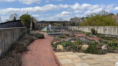
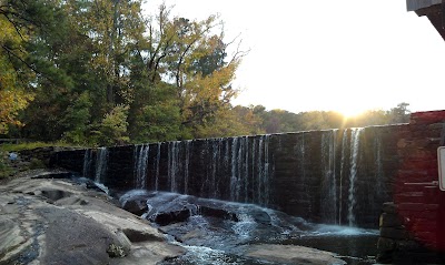
Things to Do

Hemlock Bluffs Nature Preserve

Fred G. Bond Metro Park

Downtown Cary Park

Phillips Farms

Page-Walker Arts & History Center

Apex Community Park

Marla Dorrel Park

Veterans Freedom Park

Chatham Hill Winery

Lake Crabtree County Park

Pullen Park

North Cary Park

Frankie's of Raleigh
JC Raulston Arboretum

Game On Escapes & More

Jack Smith Park
Historic Yates Mill County Park

Carpenter Park

Marbles Kids Museum

North Carolina Museum of Natural Sciences
Transportation
Cary Depot (North Platform)
Weston Parkway
Walnut St at Sturdivant Dr (EB)
Walnut St at Ledsome Ln
SE Maynard Rd at Cary Towne Blvd
N Harrison Ave at Cary Pkwy (SB)
High House Rd at SW Cary Pkwy
Chapel Hill Road at NW Cary Parkway
Paramount Pkwy at Perimeter Park Dr (WB)
Walnut Street at Cary Towne Boulevard IB
N Harrison Ave at Cary Pkwy (Cary Academy)
Walnut Street at Cary Towne Boulevard OB
SE Maynard Rd at Quinard Dr
High House Rd at NW Maynard Rd
SE Maynard Rd at Cary Village Square
NW Cary Parkway at Village Market Place OB
Walnut St at Cary Towne Center Mall
James Jackson Avenue at Cary Public Works OB
NC 55 at High House Rd
SE Maynard Rd at Reed St
Driving Directions
Driving Directions from Residential Land Services to Meta Geomatics PLLC
Driving Directions from Sullivan Surveying to Meta Geomatics PLLC
Driving Directions from Newcomb Land Surveyors, PLLC to Meta Geomatics PLLC
Driving Directions from Cooper & Associates to Meta Geomatics PLLC
Driving Directions from Krause Surveying Associates to Meta Geomatics PLLC
Driving Directions from Bateman Civil Survey Company to Meta Geomatics PLLC
Driving Directions from Mauldin Watkins Surveying to Meta Geomatics PLLC
Driving Directions from GSC Surveying Inc to Meta Geomatics PLLC
Driving Directions from Boundary Zone Inc. / ASD Surveying to Meta Geomatics PLLC
Driving Directions from Reliant Land Survey to Meta Geomatics PLLC
Driving Directions from Partin Daniel V to Meta Geomatics PLLC
Driving Directions from Draper Aden Associates to Meta Geomatics PLLC
Driving Directions from Benton W Dewar & Associates to Meta Geomatics PLLC
Driving Directions from WithersRavenel to Meta Geomatics PLLC
Driving Directions from Taylor Land Consultants, PLLC to Meta Geomatics PLLC
Driving Directions from Boundary Zone Inc. to Meta Geomatics PLLC
Driving Directions from Freehold Land Surveys Inc to Meta Geomatics PLLC
Driving Directions from Smith & Smith Surveyors to Meta Geomatics PLLC
Driving Directions from NV5 to Meta Geomatics PLLC
Ready to Get Started?
Contact us today for a free, no-obligation quote:
Phone
Office Hours
Monday – Friday, 8:00 AM – 5:00 PM
Most quotes provided within 24 hours. Emergency and expedited services available.