Land Surveyor in Garner, NC
Land surveyor in Garner, NC offering boundary and property line surveys, ALTA/NSPS land title surveys, topographic mapping, construction staking, subdivision plats, as-built surveys, and flood elevation certificates for residential and commercial sites.
Our Services
Professional Land Surveying & 3D Laser Scanning Services in Garner, NC

Land Surveying Garner, NC
Need precise Land Surveying in Garner, NC? We map infill lots off Timber Drive, stake new builds near White Oak Road, and resolve boundary and fence disputes in subdivisions. Get boundary, topographic, and ALTA/NSPS surveys that satisfy Town of Garner submittals and Wake County. We identify Neuse River riparian buffers, flood zones, and setbacks so you avoid permit delays, pool denials, and costly redesigns. Builders rely on house corner staking, grading checks, and utility as-builts along US‑70 and I‑40 projects. Order Land Surveying in Garner, NC to meet closing deadlines, verify acreage, and plan with parcel and right‑of‑way data.

Residential Land Surveying Garner, NC
If you're closing on a home near Lake Benson, adding a deck in Heather Hills, or disputing a fence along the Johnston County line, Residential Land Surveying in Garner, NC clarifies boundaries, easements, and setbacks. We map topography and floodplain near Swift Creek and Neuse buffers, produce lender-accepted boundary plats, site plans for Town of Garner permits, and recombination plats filed with the Wake County Register of Deeds. We locate City of Raleigh sewer easements, NCDOT rights-of-way on US-70 and NC 50, and CSX corridor limits to prevent encroachments. Choose Residential Land Surveying in Garner, NC for Garner’s ETJ rules.

Commercial Land Surveying Garner, NC
Choose Commercial Land Surveying in Garner, NC to verify boundaries, easements, and encroachments before you buy or build. We map ALTA/NSPS requirements, locate utilities along US 70 and Timber Drive, and confirm setbacks under Town of Garner zoning and Wake/Johnston county lines. We flag floodplain and Neuse buffer impacts near Swift Creek, document NCDOT right‑of‑way for 540 projects, and coordinate Phase I ESA findings. You get sealed plats lenders and title companies accept and fast due‑diligence turnarounds. Hire a local team that understands annexations and sewer easements to avoid delays: Commercial Land Surveying in Garner, NC solves real risks.

Construction Surveying Garner, NC
Get layout for pads, utilities, and curbs with Construction Surveying in Garner, NC. We stake building corners, stormwater BMPs, and sanitary laterals so your crews pour and trench once. Local knowledge matters: Town of Garner benchmarks, Neuse buffer limits near Swift Creek, and NCDOT encroachments along US‑70/I‑40 affect offsets and as-builts. We handle tight infill near Downtown, Piedmont clays that swell, and work zones by White Oak. Using robotic total stations and GNSS, we verify design against field conditions, deliver as-built drawings, and flag conflicts early. Need it now? Book Construction Surveying in Garner, NC to keep inspections moving.

Land Development Services Garner, NC
Choose Land Development Services in Garner, NC to turn parcels along US‑70 and Cleveland Road into buildable, compliant sites. We deliver boundary and topographic surveys, subdivision plats, construction staking, and utility mapping tailored to Town of Garner UDO, Wake County stormwater, and Neuse River buffer rules. Navigate NCDOT driveway permits, floodplain near Swift Creek, and City of Raleigh water/sewer coordination. Get precise grading data, lot yield analyses, and conflict checks that prevent redesigns and delays. If you’re planning infill near White Oak or a rural split, use Land Development Services in Garner, NC for zoning approvals and quick starts.

Home Builder & Construction Survey Services Garner, NC
Choose Home Builder & Construction Survey Services in Garner, NC to stake lots accurately along Timber Drive, US‑70 so crews pour once and pass Town of Garner inspections. We mark setbacks to Wake County code, layout foundations, verify grading for drainage near Swift Creek floodplain, and deliver as‑builts that match plans and lender requirements. Our crews coordinate utility locates in subdivisions and tracts near White Oak, adjust for Piedmont clay movement with elevation checks, and document NCDOT rights‑of‑way. Get fast scheduling before concrete, prevent rework, and keep trades aligned. Learn more: Home Builder & Construction Survey Services in Garner, NC.

Real Estate Closing & Home Owner Services Garner, NC
Searching for Real Estate Closing & Home Owner Services in Garner, NC? We deliver boundary and closing surveys, plot plans, and property line staking that meet Town of Garner setbacks, Wake County permits, and tight closing timelines. Our crews verify deeds against actual conditions in Heather Hills, Cleveland area, and new builds near White Oak, catching encroachments, misplaced fences, and shed setbacks before they delay closing. You receive clear maps, corner markings, and lender-ready reports. We flag stormwater and greenway easements, Neuse River buffers, and floodplain issues. Real Estate Closing & Home Owner Services in Garner, NC streamline next steps.

Laser Scanning Garner, NC
Laser Scanning in Garner, NC delivers dense point clouds and Scan to BIM for Revit/AutoCAD, turning sites into precise models. Use it for downtown storefront renovations, White Oak Crossing tenant fit‑outs, I‑40/US‑70 work, and Lake Benson or Swift Creek areas. Document existing MEP, slab flatness, roof lines, and façade bowing to cut rework and speed Wake County permits. Capture as‑built 2D plans from scans and measure remotely to avoid repeat site visits on Timber Drive and Jones Sausage Road facilities. Local crews schedule night scans to limit traffic impacts and rail shutdowns. Learn more: Laser Scanning in Garner, NC.
Services Areas
Serving North Carolina, NC Wake County & the Greater Triangle
Raleigh Metro
- Angier
- Apex
- Carrboro
- Cary
- Chapel Hill
- Clayton
- Durham
- Fuquay-Varina
- Garner
- Hillsborough
- Holly Springs
- Knightdale
- Morrisville
- Pittsboro
- Raleigh
- Rolesville
- Wake Forest
- Wendell
- Zebulon
Charlotte Metro
- Belmont
- Charlotte
- Concord
- Cornelius
- Davidson
- Gastonia
- Harrisburg
- Huntersville
- Indian Trail
- Kannapolis
- Matthews
- Mint Hill
- Monroe
- Mount Holly
- Pineville
- Wesley Chapel
Can't find your area?
Give us a call at (919) 402-6742. We regularly take on projects throughout the Piedmont and Coastal regions of North Carolina for commercial clients with specific needs.

Reviews
Trusted by Homeowners, Contractors & Developers Across Wake County
Precision Land Surveying Services in Garner, NC
Meta Geomatics PLLC provides land surveying services in Garner, NC, including boundary surveys, ALTA/NSPS land title surveys, topographic mapping, construction staking, and subdivision plats. Our firm performs deed and plat research, field measurements, and prepares sealed survey maps for permitting, design, and real estate transactions. Services also include elevation certificates for flood insurance, as-built surveys, easement and right-of-way surveys, and site layout for utilities and grading. Coverage includes Garner and nearby Wake/Johnston County communities, with coordination for planners, engineers, and contractors.
About Garner, NC
Garner, NC blends small-town roots with rapid growth, originating as a rail stop and evolving into a hub for families and entrepreneurs. Residents value its accessible infrastructure, business-friendly zoning, and active parks system. Notable landmarks include Garner Town Hall, White Deer Park Nature Center, Lake Benson Park, Garner Performing Arts Center, and WakeMed Garner Healthplex. Their crews map parcels around White Oak Crossing, locate utilities near US-70/US-401 corridors, and prepare plats that align with Garner’s subdivision and zoning requirements. They verify boundaries for infill lots off Aversboro Road, provide ALTA/NSPS surveys for commercial redevelopments along Timber Drive, and deliver construction staking and as-builts coordinated with Wake County and Town of Garner review processes.
Garner's population is 32,188. City center coordinates: 35.6997, -78.6142. Summers are humid and hot, winters are mild with occasional freeze-thaw cycles, and rainfall is well-distributed with intense summer storms. Meta Geomatics PLLC schedules fieldwork to avoid stormwater surges, uses stable control in expansive Piedmont soils, and applies RTK/OPUS workflows compliant with NC Board of Engineers and Land Surveyors standards and NCGS/NCAC requirements. - Heather Hills: Boundary surveys for home additions and fence permits; quick lot line staking. We prioritize eco-friendly practices, using recycled materials and sustainable methods, while supporting Garner’s community through local hiring and partnerships. Our work helps protect Garner, NC’s natural resources and neighborhoods. For reliable Land Surveyor services in Garner, contact Meta Geomatics PLLC today.

Light Rain
Temperature
Wind Speed
Humidity
Neighborhoods We Serve
Things to Do

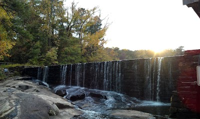
Lake Benson Park

White Deer Park
Historic Yates Mill County Park

Garner Recreational Park

North Carolina Museum of Natural Sciences

Pullen Park
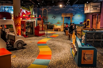
Marbles Kids Museum
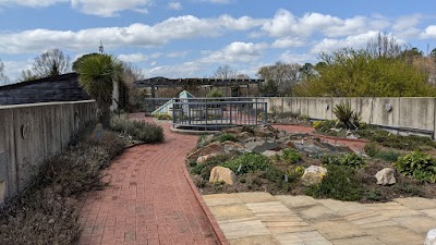
JC Raulston Arboretum

Rush Hour Karting

Garner Veterans Memorial

Frankie's of Raleigh

Centennial Park

Adventure Landing

North Carolina Museum of Art

Kens Korny Corn Maze

Go Play Outside Now (By Appointment only)

Conundrum Escapes LLC

South Garner Park

Garner Performing Arts Center
Transportation
Garner Station Blvd at Rupert Rd
Garner Rd at Vandora Springs Rd
Garner Rd at Broughton St (Garner Elementary)
Garner Rd at Tryon Rd (NB)
Vandora Springs Rd at Methodist Dr
Poole Dr at Aversboro Rd (Garner Family Practice)
Garner Rd at Raleigh Pines Dr (SB)
Garner Rd at Tryon Rd (SB)
White Oak Shopping Center Park & Ride
Garner Rd at Benson Rd
Garner Station Blvd at Lennox Place
Garner Rd at Willow Vista Rd (SB)
Garner Rd at Hilltop Dr (SB)
Garner Rd at Meadowbrook Dr (NB)
7th Ave at Garner Town Hall (SB)
Garner Station Blvd at Fayetteville Rd (Goodberry's)
Garner Rd at Creech Rd (Garner Recreational Park)
Garner Rd at Meadowbrook Dr (SB)
Rush St at Garner Rd
Garner Rd at Willow Vista Rd (NB)
Driving Directions
Driving Directions from Krause Surveying Associates to Meta Geomatics PLLC
Driving Directions from RWK,PA Engineering and Surveying to Meta Geomatics PLLC
Driving Directions from Poole Land Surveying, PLLC to Meta Geomatics PLLC
Driving Directions from Newcomb Land Surveyors, PLLC to Meta Geomatics PLLC
Driving Directions from Chandler Land Surveying PA to Meta Geomatics PLLC
Driving Directions from GSC Surveying Inc to Meta Geomatics PLLC
Driving Directions from Blew & Associates, P.A. to Meta Geomatics PLLC
Driving Directions from True Line Surveying to Meta Geomatics PLLC
Driving Directions from Scalice Land Surveying, P.C. to Meta Geomatics PLLC
Driving Directions from Stewart Proctor PLLC to Meta Geomatics PLLC
Driving Directions from Gilbert Land Surveying to Meta Geomatics PLLC
Driving Directions from On The Level Land Surveying, PLLC to Meta Geomatics PLLC
Driving Directions from Southwind Surveying & Mapping to Meta Geomatics PLLC
Ready to Get Started?
Contact us today for a free, no-obligation quote:
Phone
Office Hours
Monday – Friday, 8:00 AM – 5:00 PM
Most quotes provided within 24 hours. Emergency and expedited services available.