Land Surveyor in Holly Springs, NC
Land surveyor in Holly Springs, NC providing boundary and property line surveys, ALTA/NSPS surveys, topographic mapping, construction staking, subdivision plats, as-builts, FEMA elevation certificates, and site plans for residential and commercial projects.
Our Services
Professional Land Surveying & 3D Laser Scanning Services in Holly Springs, NC

Land Surveying Holly Springs, NC
Choose Land Surveying in Holly Springs, NC when you need boundaries before building a fence, pool, or addition in neighborhoods like 12 Oaks or Sunset Ridge. We map lot lines, easements, and setbacks to satisfy Wake County permits and HOA approvals, preventing encroachments. For closings along NC 55 or Avent Ferry Road, we deliver ALTA/NSPS, topographic, and construction staking that keep projects on schedule. Our crews navigate clay soils and stormwater rules around Utley Creek and Bass Lake. We mark utilities, verify drainage, and resolve disputes. Start here: Land Surveying in Holly Springs, NC—Land Surveying in Holly Springs, NC.

Residential Land Surveying Holly Springs, NC
Choose Residential Land Surveying in Holly Springs, NC when you need boundaries for closing, building, or resolving fence disputes near Bass Lake. We map deeds, plats, and right‑of‑way lines, mark setbacks required by the Town’s UDO, and show stream buffer limits on lots near Utley Creek. Get site plans for permits, staking for additions, elevation certificates for lenders, and recombination plats for lot line adjustments. We coordinate with Wake County permitting, NCDOT encroachments, and utility easements. Request Residential Land Surveying in Holly Springs, NC to prevent encroachments, avoid HOA violations, and document topography for drainage fixes after heavy storms.

Commercial Land Surveying Holly Springs, NC
You need clear answers fast. Commercial Land Surveying in Holly Springs, NC verifies boundaries, easements, and topography for sites along NC 55 and the Business Park. We perform ALTA/NSPS Land Title Surveys, due diligence mapping, zoning summaries tied to the Town UDO, and Phase I ESA coordination. Identify encroachments, riparian buffers, flood risks, and utility conflicts before you close. Meet lender, title, and attorney requirements with sealed plats and digital deliverables aligned with Wake County GIS. We stake construction, support NCDOT driveway permits, and document as-builts. Choose Commercial Land Surveying in Holly Springs, NC to keep approvals moving quickly.

Construction Surveying Holly Springs, NC
Choose Construction Surveying in Holly Springs, NC to keep builds aligned with standards and Wake County inspections. We stake building corners, curb and gutter, utilities, and retaining walls, using local control and NAVD88 to avoid elevation errors around NC 55, Ting Park, and 12 Oaks. Our crews resolve clay soils, steep lot grades, and tight setbacks common in subdivisions. We deliver as-builts required for COs, confirm stormwater BMPs, and verify NCDOT tie-ins on widening projects. Track progress with cut/fill and slab offsets. Avoid utility conflicts near greenways and waterlines. Hire Construction Surveying in Holly Springs, NC for precise layout.

Land Development Services Holly Springs, NC
You need precise, local guidance to make a Holly Springs parcel buildable. Our Land Development Services in Holly Springs, NC include boundary and topographic surveys, subdivision plats, construction staking, and utility as-builts aligned with the Town UDO, Neuse River buffers, and NCDOT access along NC 55 and Avent Ferry Road. We locate wetlands near Bass Lake and Middle Creek, confirm setbacks, and shape grading to cut earthwork and change orders. We manage TRC submittals and resolve comments to keep schedules moving. Choose Land Development Services in Holly Springs, NC to speed permits, control costs, and reduce risk. Get defensible survey deliverables.

Home Builder & Construction Survey Services Holly Springs, NC
Need layout for a build in Holly Springs? Our Home Builder & Construction Survey Services in Holly Springs, NC verify setbacks, lot coverage, and grading to meet Town of Holly Springs requirements. We stake property lines, corners, and foundations, confirm elevations on clay and sloped sites near Bass Lake or Twelve Oaks, and document as-builts for inspections and CO. We flag easements and NCDOT NC‑55 rights‑of‑way to prevent encroachments. Expect coordination with your framer and concrete crew, plus digital deliverables for permit submittals. Choose Home Builder & Construction Survey Services in Holly Springs, NC to avoid rework and delays.

Real Estate Closing & Home Owner Services Holly Springs, NC
Need surveys for a closing, permit, or improvement in Holly Springs? Our Real Estate Closing & Home Owner Services in Holly Springs, NC verify boundaries, identify encroachments, and stake corners in 12 Oaks and Sunset Ridge. We deliver mortgage/ALTA drawings lenders accept, plot plans for Town permits, and setback checks for pools, decks, or fences. Resolve missing pins near construction, utility easements along Bass Lake Road, and Neuse riparian buffers affecting yards. Avoid closing delays at the Wake County Register of Deeds with plats and title coordination. Request Real Estate Closing & Home Owner Services in Holly Springs, NC.

Laser Scanning Holly Springs, NC
Laser Scanning in Holly Springs, NC delivers millimeter-accurate measurements in hours, cutting rework on 12 Oaks renovations, upfits at Holly Springs Towne Center, and additions needing Town of Holly Springs permit sets. We capture high-density point clouds, create Scan to BIM for Revit and AutoCAD, and extract as-built 2D plans. Verify MEP routes, plumb, slab flatness, and roof pitch before ordering materials. Document stormwater features near Bass Lake and setbacks along NC 55 projects. Access a digital record for measurements. Choose Laser Scanning in Holly Springs, NC to coordinate. Laser Scanning in Holly Springs, NC keeps projects moving.
Services Areas
Serving North Carolina, NC Wake County & the Greater Triangle
Raleigh Metro
- Angier
- Apex
- Carrboro
- Cary
- Chapel Hill
- Clayton
- Durham
- Fuquay-Varina
- Garner
- Hillsborough
- Holly Springs
- Knightdale
- Morrisville
- Pittsboro
- Raleigh
- Rolesville
- Wake Forest
- Wendell
- Zebulon
Charlotte Metro
- Belmont
- Charlotte
- Concord
- Cornelius
- Davidson
- Gastonia
- Harrisburg
- Huntersville
- Indian Trail
- Kannapolis
- Matthews
- Mint Hill
- Monroe
- Mount Holly
- Pineville
- Wesley Chapel
Can't find your area?
Give us a call at (919) 402-6742. We regularly take on projects throughout the Piedmont and Coastal regions of North Carolina for commercial clients with specific needs.

Reviews
Trusted by Homeowners, Contractors & Developers Across Wake County
Accurate Land Surveying Services in Holly Springs, NC
Meta Geomatics PLLC provides land surveying services in Holly Springs, NC, including boundary surveys for residential lots, ALTA/NSPS land title surveys, topographic mapping for design, construction staking for builders, and subdivision platting. Our firm prepares elevation certificates and FEMA floodplain determinations, performs easement and right‑of‑way surveys, and offers as‑built surveys for permit closeouts. Services support site planning, utility layout, and property line resolution. Deliverables include CAD files, GIS-compatible data, and sealed plats compliant with Wake County and Town of Holly Springs requirements.
About Holly Springs, NC
Holly Springs, NC grew around freshwater springs and a crossroads community, evolving into a planned town with strong civic amenities. Residents and businesses value its safe neighborhoods, modern infrastructure, and active parks system. Notable landmarks include Holly Springs Town Hall, Ting Park, Bass Lake Park, Holly Springs Cultural Center, and UNC Health Rex Holly Springs Hospital. From downtown parcels near the Town Hall Commons to boundaries around Bass Lake Park and new builds off Avent Ferry Road, crews adapt methods to site conditions and local ordinances. They coordinate with Wake County records, deliver clear plats for planning submissions, and offer quick turnarounds for lot splits, elevation certificates, and construction staking across Holly Springs neighborhoods.
Holly Springs's population is 41,239. City center coordinates: 35.6516, -78.8339. The town has a humid subtropical climate with hot, storm-prone summers and mild, wet winters. Meta Geomatics PLLC accounts for clay-rich Piedmont soils, seasonal groundwater fluctuations, and stormwater-driven erosion by scheduling fieldwork around rainfall, using GNSS with robust control, and preparing plats compliant with NC Board of Examiners standards and NCGS/21 NCAC survey requirements. In 12 Oaks, we provide boundary and topographic surveys for new builds. In Sunset Ridge, we handle plat updates and pool permits. In Holly Glen, we offer fence line staking. In Braxton Village, we deliver construction staking and lot corners. Our team uses recycled materials and sustainable methods where feasible, reducing waste while supporting Holly Springs’s community through local partnerships and projects across Holly Springs, NC. For reliable Land Surveyor services in Holly Springs, contact Meta Geomatics PLLC today.

Overcast Clouds
Temperature
Wind Speed
Humidity
Neighborhoods We Serve
Things to Do

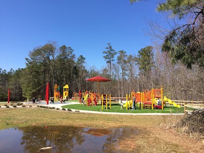
Bass Lake Park

Sugg Farm at Bass Lake Park

Holly Springs Cultural Center
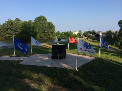
Veterans Park

Parrish Womble Park

Womble Park Athletic Fields

Pullen Park
Jones Park

Hemlock Bluffs Nature Preserve
JC Raulston Arboretum
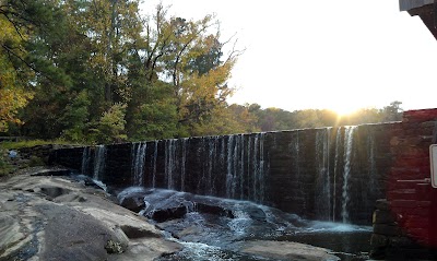
Historic Yates Mill County Park

Whole Brain Escape

Ting Park

North Carolina Museum of Natural Sciences

Marbles Kids Museum
Lake Johnson Park

Changing Tomorrow Farm

Dorothea Dix Park

North Carolina Botanical Garden

North Carolina State Capitol
Transportation
Main St at Center St (SB)
Sportsmanship Way at Ting Park Park-and-Ride
Bus Stop
Apex Peakway at Hughes St (Walmart)
Fuquay-Varina South Park-and-Ride
Mason St at Apex Town Hall (SB)
Hughes St at Williams St (Compare Foods Park-&-Ride (PM))
Star Bus
W Williams St at Apex Peakway (NB)
Laura Duncan Rd at Apex Peakway (SB)
N Salem St at Hunter Street OB
Laura Duncan Rd at Apex Peakway (NB)
Apex Peakway at Hughes St (Cambridge Village)
Crescent Commons Dr at Kildaire Farm Rd
Chatham St at Hughes St
Mason St at Old Mill Village Dr (Apex Town Hall (NB))
Hughes St at Chatham St
Southern Express Inc
Hughes St at James St (SB)
Hughes St at James St (NB)
Driving Directions
Driving Directions from Benton W Dewar & Associates to Meta Geomatics PLLC
Ready to Get Started?
Contact us today for a free, no-obligation quote:
Phone
Office Hours
Monday – Friday, 8:00 AM – 5:00 PM
Most quotes provided within 24 hours. Emergency and expedited services available.