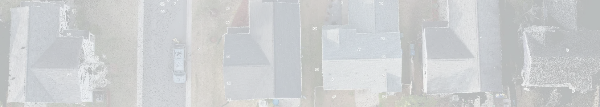
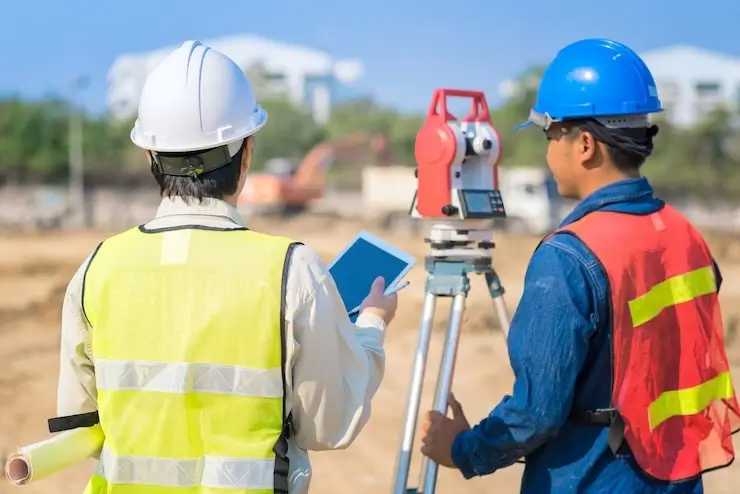
Accurate measurements along with the third dimension provide realistic data collection that applies to many industries. Advanced technology has blessed the modern world with many tangible gifts and a laser that bounces light pulses back and forth from the surface to the scanner is one. LIDAR or light detection and ranging is an alternative term. Among several important applications in architecture and engineering, heritage buildings, film, and forensics, 3D land surveying accurately reflects the land features and topography. Read on to learn how 3D laser technology improves speed, reliability, and efficiency in terms of land and property measurements. No wonder technology spreads fast now.
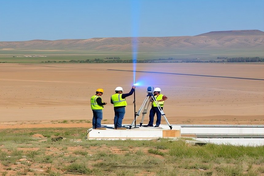
How does 3D laser work?
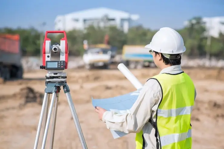
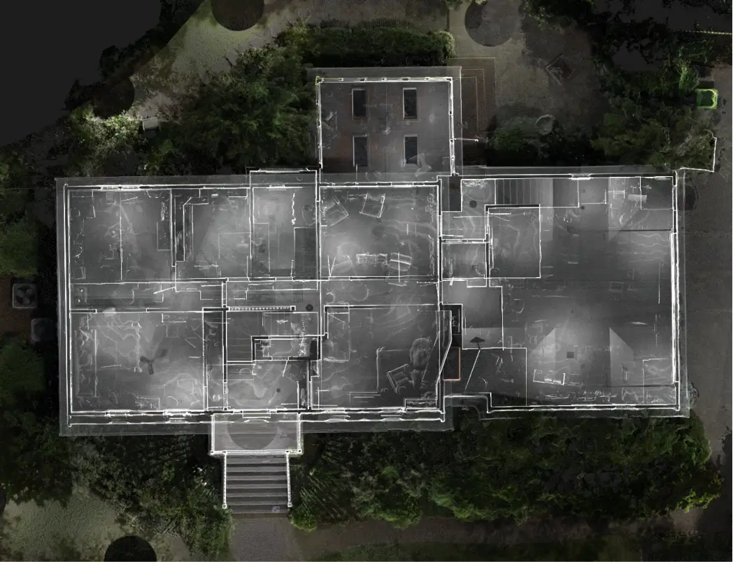
Traditional survey methods require a lot of time and labor in comparison. Besides, 2D shows only flat surfaces. The laser pulses of light that bounce off surfaces help to create a point cloud that accurately shows the features of the scanned surface. The accuracy extends to millimeter levels. The gloriously detailed 3D model serves infinite purposes. Analysis of the scanned data uses software like Leica Cyclone. CloudCompare is an open-source software for the same task. Besides working extremely fast, 3D laser scanners are affordable and do not harm the environment. Safety, visualization, and linkage with other software are further benefits of 3D laser data.
Benefits of 3D property survey
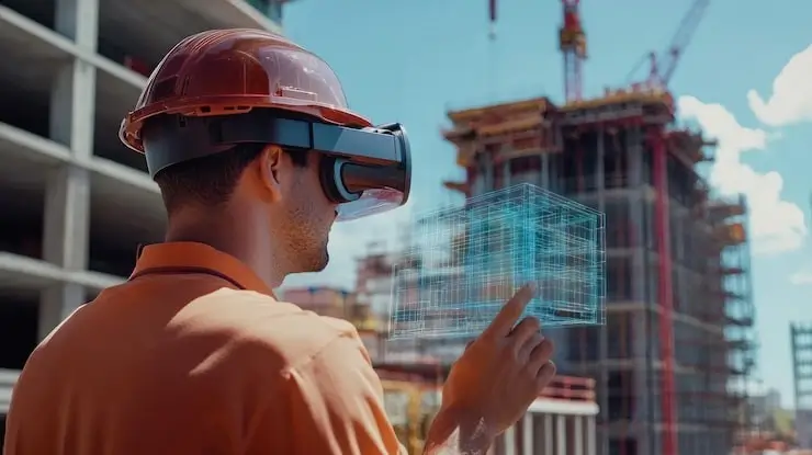
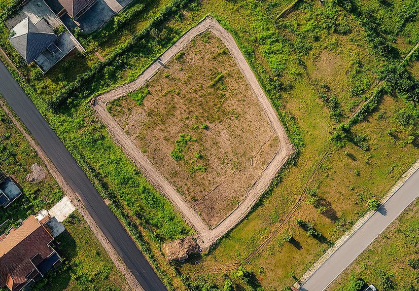
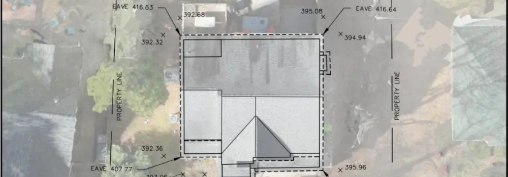
The greatest physical assets humanity possesses are land and buildings. Crowded urban areas with mighty buildings and vast crowds pose many survey challenges. In large land parcels, measurement of land and buildings becomes quite a hassle. That is when the 3D laser proves a blessing with ease, cost-effectiveness, and pinpoint precision. Integrating with Building Information Modeling and Geographic Information Systems, the 360-degree view serves many crucial tasks. Even if obstacles arise on the land, the 3D laser has no problem.
Comparable to film characteristics in a sense that captures all the ups and downs, vegetation, and rocks, 3D laser captures the essence infinitely better.
Avoiding human error
Conventional mapping techniques raise the possibility of mistakes being made. A small slip can turn into a large error. Detailed data like measuring angles, size, and elevation could lead to mistakes. Even the artificial intelligence that is the current rage globally is known to make mistakes. That is why cross-checking is always required. With laser technology, the chances of error do not exist. Measurements could be repeated to be doubly sure. Laser technology is fast and easy.
Knowing the details of existing land or buildings, and preparing for the construction of residences or commercial structures could not be easier or better. Drawing up architectural plans and organizing the workforce or transporting materials and supervising work in progress, the 3D laser helps all the way. The land survey company becomes a handy partner during those stiff official procedures and the obtaining of permits that sometimes require repeated mapping. While buying or selling land or property, precise mapping in the present rather than relying on older data is crucial to avoid wrong data and losses. Land and building features change over time and it is better to be safe than sorry.
Fluid communication helps both sides
Documents talk with names, facts, and figures but they are not the end. Sustained complex work like architectural plans, constructions, and purchases require close coordination with the survey company which plays an instrumental role. The survey company’s reputation and history, reviews, and ratings all matter in bringing about trust and cooperation. If customers feel at home and can express themselves freely and get timely and regular feedback, so much the better.
The cutting-edge advanced technology and equipment ensure that 3D land surveying works like a dream. No matter what the dimensions or location of the land in question, anticipate exact data obtained within the stipulated time and without excessive spending. Along with the concern to succeed with business solutions is the commitment to clients and their welfare. Feeling for the client and the property lies at the heart of the company.
With buildings, factories, and land, it is a heart-in-mouth situation with terrible anxieties for many owners in the absence of updated data. It is a mystery that a 3D property survey can be eliminated with all the right data. Get all the property records right, especially if it is old or unreliable data. There may be no data for properties acquired long ago. It will be money well spent and peaceful sleep will follow to know that all the correct data is now available and the records updated. More than the authorities who may sometimes look the other way, the owner needs to get property matters moving through initiatives in time. Guard private interests firmly.
Professional worlds across industries require accurate precision and superior efficiency nowadays, promoted by the digital environment. The maze of the urban forest and complex factory work procedures, architecture, and construction, require elaborate 3D laser applications. Speeding and refinement go together and software for 3D mapping works harmoniously with integrated systems in absolute safety even in difficult environments. Work hand in hand with the land survey company and reach the heights of success in the personal and business worlds.